Kolkata Riverfront
A to-be-revived master plan for revival
Text: Das, Partha, Kolkata
Kolkata Riverfront
A to-be-revived master plan for revival
Text: Das, Partha, Kolkata
The Hooghly River links the metropolis of Kolkata to the industrial city of Howrah.In consequence of decreased goods traffic, the docks became neglected and had been left to an uncontrolled valorisation by private investors for a long time. In order to utilise the river banks for the city again, a revaluation is needed. A new planning proposal does, for the first time, also include Howrah. But it might come to nothing, since the responsible politicians do only think in legislative terms regardless of the long-term consequences.
With market liberalisation and new economic policies from the beginning of the 1990s, India’s cities have been constantly changing their face, expanding and giving birth to media centres, business parks, residential enclaves, shopping malls and new infrastructures on a massive scale and number. Beyond these projects, strongly wanted and boldly financed by private investors under the benevolent eye of most public sector actors, the urban riverfronts offered particular scope for concerted intervention.
The first large-scale riverfront development project started in Ahmedabad, the biggest city in semi-arid Gujarat. There, the Sabarmati River, originally retaining water for only 2-3 months in the year, became object of ambitious plans. The self-financed Sabarmati Riverfront Project, initiated in 1997 thanks to effective lobbying by architects and planners, is being realised on a stretch of over 10 kilometres of length. Its overall successful example has attracted Indian planners‘ and urbanists‘ as well as public attention on the rivers. Apart from the action plan and various interventions of different scale – the latest on occasion of the Commonwealth Games in 2010 – on the Yamuna River in India‘s capital city Delhi, many riverfront development projects are currently being carried out in minor cities within the framework of the national urban renewal programme JNNURM. One can even recognise a link between Ahmedabad‘s energetic “call” to care about waterfronts and the upgrading of Mumbai‘s sea front – the Marine Drive –, completed in the last decade.
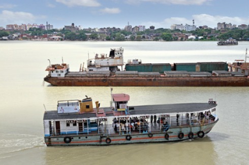
Against the background of India-wide efforts to bring cities and their rivers closer together, the need for action was acknowledged also in Kolkata, where the Hooghly River had experienced a decade-long neglect. The situation in Kolkata differentiates itself from Delhi or Ahmedabad‘s situation, as the Hooghly – which is almost two kilometres wide near Kolkata – does not dry up during the summer and winter season and is still used as a way of communication. In 2005, after being prodded by several well known citizens, architects and urban planners from Kolkata and other cities, West Bengal‘s state government decided to prepare a status report on the Hooghly Riverfront.
Rethinking the land use
The final status report, with directions towards preparation of a Master Plan and its phased implementation, concerned a 60 km-long stripe, one kilometre wide from the high flood level on either side of the river. The first 500-meter stretch was the “core area” of intervention, whereas the next 500-meter stretch, termed the “fringe area”, was envisioned as a buffer between the core area and the rest of the city, where minor changes were to be implemented.
Overall, the study shows that the land use pattern is arbitrary and, among others, not compatible with the central business district that is next to it; in most cases, the existing functions and uses have no relationship with the river. Latter fact can be read as a legacy of Kolkata‘s urban development in the colonial time [see “Kolkata and Dhaka – an intertwined history”]. Already in British times, the introduction of railways and automobiles caused the decline of warehousing activities on the riverfront and warehouses and industrial premises, abandoned, became liabilities for the Port Trust, which ever since has been unable to maintain them. As a consequence, all along the 20th century, unscrupulous developers moved in and tall, ugly matchboxes destroyed the urban fabric of both riverbanks. Today‘s land use is thus characterised by the unordered coexistence of commercial and service activities – these are in fact preponderant – and residential as well as institutional/administrative uses, with a very small presence of industries, north to Howrah Bridge. Infrastructural uses for roads, tramways and bus lanes are non-adequate to the actual demand.
One of the first recommendations of the status report was hence that the incompatible and irrelevant uses would be removed from the core area. Facilities such as petrol stations, bus terminals etc. ought to be relocated to other sites, whereas the mostly vacant godowns, warehouses and stores should be acquired by the government and reused or replaced by appropriate functions coherent with the new plan, foreseeing a commercial-cum-leisure land use. Since the analysis showed a major shortfall of open spaces, creation of strands, parks and spaces for recreation in the place of idle constructions was envisioned. Additional land for passive recreation was to be gained via the implementation of measures of protection from the strong current of the river and its tides. During high tide, the Hooghly‘s water flows horizontally into both riverbanks and inundates a large area, which becomes muddy and is left full of garbage when the water recedes. Therefore it was proposed that the two riverbanks be contained with hard edges built along the low tide mark, so that the water levels would rise or fall vertically during tides and the land along the riverfronts be increased.
Howrah – the “other”
A particularity the status report had soon to acknowledge was that the Hooghly River is not just “Kolkata‘s river”, but actually flows between two cities with individual municipal corporations and political bodies. In fact, over the last century, Kolkata and Howrah riverfronts functioned as two orphaned children separated from each other, surviving on leftovers and alms doled out by different authorities. This raised issues of jurisdictional nature, making the Hooghly riverfront case unique in India. Howrah, a one-million city known over centuries as Kolkata‘s industrial “backstage” and recently developing into an engineering city, is chronically under-served with regard to infrastructure; it is confronted with grave pollution, environmental, transportation and overpopulation problems. In particular, the Howrah portion of the project‘s “core area” is filled up with old industrial buildings and vacant warehouses; morphologically, it lacks the homogeneity of the Kolkata core area. However, many of these buildings were found in good shape and indeed offer a very interesting assortment of envelopes suitable for adaptive reuse.
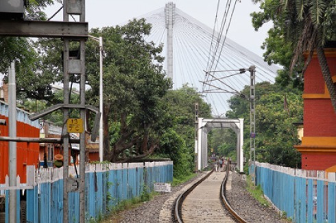
Additionally, the last destination for most trains coming to eastern India from the rest of the country is not Kolkata, but Howrah‘s railway station. People coming from different parts of the country have to cross the river to get into Kolkata; similarly, people from Kolkata have to travel through the city and cross the Hooghly to leave for most destinations. A few thousand people move everyday via different modes of transport in both directions across the riverfront. On Kolkata‘s side, most of this traffic passes through one single axis, Strand Road, creating traffic congestion along the riverfront, to which adds the commercial north-south oriented traffic connecting the docks, at Kidderpore, to Howrah‘s railway station and beyond. Due to this barrier, the riverfront not only has poor visibility from the city but poor accessibility as well. The problem was to be overcome by building low level bridges across the river, which in turn would have been connected to a ring road so to free the riverfront from the unrelated traffic. The Howrah riverfront would become an extension of Kolkata‘s congested central business district, with reciprocal advantage. A series of elevated pedestrian bridges over the circular railway would encourage people on Kolkata‘s side to cross over to the riverfront area.
Perverting planning
The presentation of the first draft proposal in November 2006 yielded no result. Not only were politicians only eager to know how much of the project could be implemented during their tenure to appraise whether they would get some credit in their respective areas or departments. Also, no feedback ever reached the architectural studio from the different stakeholders in spite of their commitment to make own recommendations to be integrated in the status report. In 2007, the Urban Development Department presented the scheme to the Chief Minister as part of a new Structure Plan for Kolkata. But again, nothing was aspired.
What happened? Why committing an expensive (though co-sponsored by donations from the UK, keen to be part of the future development project) status report to then ignoring its recommendations, and worse, abandoning the endeavour? One could now complain about West Bengal politicians‘ failure to realise the project‘s potential as a catalyst for development, or about the apathy of its public administration. A consideration of the political moment in which the proposal was submitted shows, however, another side of the story. After facing public ire, which extended from the countryside to the urban areas, for trying to forcefully acquire land from villagers of Singur and Nandigram for setting up new industries, the government was – it is the case to say – literally scared to tackle such a large project as it also required acquiring land from heterogeneous owners. Neither the tremendous pressure from the media, writing about the Government‘s dragging feet from a project it had itself initiated, nor the support from NGOs and the Bengal Chamber of Commerce changed anything.
Everywhere, in the West as much as in India, the realisation of big public programmes for urban development depends on the planning agencies‘ ability to comply with both a government‘s capacity to envision large-scale projects and its authority over the concerned areas. Everywhere, when these are controlled by different elected municipalities, such programmes require longer times. Yet the political culture of West Bengal‘s rulers was such that, for many years, planning under their direction verged on grotesque dimensions. To comply with such a rulers‘ class, a planner would have to divide a project into several small projects, ensure completion within the tenures of the ruling parties, and select areas where the local councillor or legislator has two to three years of tenure left so to ensure that he/she, and not his/her followers, will receive the merit of the achievement!
Against this background, the “lesson learnt” was to keep on hold larger projects till a new elected municipal government would replace the old one. In 2010, this happened: municipal elections were won by the Trinamul Congress, which replaced the Left Coalition. The new government promised to implement projects for the betterment of Kolkata. So the Kolkata portion of the Riverfront Project may happen. In its eagerness to show people of Kolkata that it means business, the government now appointed a local university‘s School of Planning and Architecture to prepare a new plan.


0 Kommentare